To Wade Crowfoot: Let the good dog of science in
July 8, 2024
Will Harris
By WILL HARRIS
True objectivity is an ideal, a peak never quite summited. But with relevant information and science, the baggage of bias and ignorance can be shed to achieve a high and rightful perch from which consequential decisions can be made responsibly.
Unfortunately, when it comes to the Oceano Dunes State Vehicular Recreation Area (SVRA), the California Department of Parks and Recreation (DPR) is still at base camp, mired in politics, ignoring science and information received. DPR sits, boots off, choosing not to rise above the aggressive assumptions and lies of the San Luis Obispo Air Pollution Control District (SLOAPCD) that have cost DPR more than $25 million and counting.
I have previously explained in various public forums DPR’s sad history with the SLOAPCD and its Scientific Advisory Group (SAG). I have detailed dune formation processes, PM10 measurement and related regulations, SLOAPCD and SAG accusations against Oceano Dunes and off-highway vehicle (OHV) recreation, and the findings and publication of the Scripps investigation which disproved those accusations. Restating that here would be redundant.
So let’s cut to the latest.
In its third version of a Stipulated Order of Abatement imposed against DPR, the SLOAPCD claims that the OHV riding area of the park emits just that much more PM10 dust via the natural dune formation process known as saltation than the same area emitted from a time when there was no OHV recreation. And so their stated goal is to reduce PM10 emissions from Oceano Dunes to a level that existed before there was OHV recreation in the dunes.
Let’s workshop this claim and goal hypothetically using round numbers.
We’ll start with 1000 acres of open sand dunes. The SLOAPCD position is that before OHV recreation, those acres emitted so many metric tons of PM10 per day under a given windy spring day scenario. Let’s say that amount is 100 metric tons per day.
And now, imagine those same acres as open to OHV recreation. The SLOAPCD claim is that those same dunes where OHV riding now occurs emit just that much more PM10 via saltation under the same windy spring day scenario. Let’s say that amount is 200 metric tons per day.
These PM10 amounts are called “mass emissions” that come from this specific 1000 acre area of the dunes, and they are determined from computer modeling. For that given windy spring day, PM10 from the dunes is modeled such that it lofts from the 1000 acre dune surface and then drifts and disperses downwind.
Computer models are intended to simulate real world scenarios. They are based on data put into the model as well as assumptions that are by necessity built into the model.
Data that have already been collected and put into the dune computer model include the area of the dunes (for example, 1000 acres), the wind direction and wind speed, and the PM10 emissive potential of the dune surface. That last item is known as dune surface emissivity, or simply, emissivity.
Emissivity data have been collected from a multitude of points within Oceano Dunes using an instrument called the PiSWERL. The PiSWERL, in broad terms, simulates the saltation process. It looks like an inverted, high tech soup pot attached to a baby stroller, and it can measure the emissivity at any discreet point where the pot is placed on the dune surface.
The emissivity measurement is made thanks to a spinning blade inside the pot. The blade spins at set rotational speeds above the dune surface creating a small cyclone within the pot. In so doing, bits of sand are kicked up by the swirling wind and bounced around, and with that sand are smaller bits of dust. The PiSWERL measures the concentration of suspended PM10 dust within the pot when the blade is spinning at a given constant speed. That value is then considered representative of the PM10 dust emissivity for that spot within the dunes.
To date, hundreds of emissivity measurements have been made at Oceano Dunes over several years. The vast majority of measurements were within the OHV riding area of the dunes, but a sizable amount of emissivity measurements were also taken on dune surfaces outside the OHV riding area. All of these emissivity measurements inform the computer model so that the “mass emission” and downwind dispersion of PM10 dust from the dunes can be simulated.
To determine the emissivity of a dune area before there was OHV recreation, the SLOAPCD’s SAG used the emissivity data collected from those locations outside the OHV riding area. The data were combined and in a general sense averaged and found to be less “emissive” when compared to similarly combined and averaged emissivity data from the riding area. That averaged, less emissive value was designated by the SLOAPCD and the SAG as “pre-disturbance,” and they consider it representative of the the emissivity of the OHV riding area of Oceano Dunes before there was OHV recreation.
Using the SLOAPCD/SAG logic in our round-number hypothetical example, 200 metric tons of PM10 dust emit from our 1000 acre dune area with OHV recreation. That same area under a “pre-disturbance” scenario emits only 100 metric tons. The difference (200 – 100 = 100 metric tons) represents the mass emissions of PM10 dust from the dunes that are in excess of naturally occurring mass emissions.
Of note, there is no way to directly measure mass emissions from a dune surface area that is one acre, let alone 1000 acres. Mass emission values determined for Oceano Dunes exist in a computer model only. This is problematic because the standard validation process for a computer model, where predicted data are compared with data collected from the real world to determine model accuracy, is fundamental to a computer model’s development and refinement. But for now, let’s set that concern aside and ask the question, what is to be done with the mass emissions that are “in excess of naturally occurring emissions?”
Here again, computer modeling is used to simulate “mitigations,” such as vegetation plots, that can be placed in the dunes to stop the saltation dust emission process.
In our hypothetical case, the 1000 acre dune area with OHV riding produces 200 metric tons of PM10 dust. Without OHV riding, the dune area produces 100 metric tons. Therefore, covering half the dunes with vegetation plots will reduce “mass emissions” of PM10 dust from the dune surface by half—to 100 metric tons. This means that with the “mitigations” of sand-covering vegetation plots in place, PM10 dust emissions from the OHV riding area no longer exceed “naturally occurring” mass emissions of PM10 dust. It also means the OHV riding area is 50% smaller.
In the same way, the SLOAPCD and the SAG dictated to DPR where to place more than 740 acres of vegetation plots within the Oceano Dunes SVRA. Originally, the SVRA had 1500 acres of dunes open to recreation, so now, with these plots, half of the park has been closed off and covered. And of note: Before this SLOAPCD/SAG handywork, the dunes within the SVRA consisted mostly of open sand sheets. The dunes had always been that way, long before OHV recreation, so the vast majority of the vegetation plots positioned by the SAG are unnatural, placed where there never was dune vegetation.
Like our hypothetical example, the SLOAPCD/SAG computer model, with the 740+ acres of vegetation plots in place and inputted to the model, now shows that “mass emissions” of PM10 dust from the park have been reduced to a level that is less than “pre-disturbance” mass emissions. In the parlance of the SLOAPCD, the “emissions in excess of naturally occurring emissions” have been eliminated.
So. Well and good, right?
Not exactly, no.
As stated by SAG member and primary inventor of the PiSWERL, Dr. Jack Gillies, at a March 24, 2023 meeting of the state’s Off-Highway Motor Vehicle Recreation Commission, the PM10 modeled to be downwind of Oceano Dunes was assumed to be “predominantly mineral dust based on the emissivity values from the PiSWERL device which only measures emissivity of mineral dust.”
In other words, the dune emissivity values inputted to the SAG’s computer modeling are based on PiSWERL-measured emissions from the dune surface that are 100% mineral dust. That means the modeled PM10, whether it is just above the dune surface or dispersed downwind, is assumed to be 100% mineral dust, nothing else. As I have previously referenced, the Scripps investigation found that the actual PM10 downwind of Oceano Dunes contained only 14% mineral dust. That is real world data that invalidates the SAG computer modeling. But for the sake of this discussion, let’s set that aside and think only about PM10 coming from the dunes as simulated by the computer model.
These mass emissions, whether modeled as from a “pre-disturbance” dune surface or from a surface with OHV recreation, are based on emissivity data collected by the PiSWERL, a device that only measures emissivity from a dune surface as 100% mineral dust.
Smoke from a campfire can sting the eyes of those sitting near it, or it can be whiffed from a distance, bringing to mind a pleasant outing. But whether near or far, it’s still smoke from a campfire. The computer-based concept of “mass emissions” of PM10 dust from Oceano Dunes dictates that PM10 from the dunes is lofted by the wind and entrained in the air. And whether those emissions are dense and just above the dune surface or diffuse and two miles downwind, the modeled concept also dictates that the composition of the mass emissions is the same throughout—100% dust from the sand dunes.
Except that it’s not, as the published 14% dust findings by Scripps indicate. As well, even the SAG and SLOAPCD, undertaking a subsequent investigation prompted by the Scripps work, found dust to be a minority percentage of the downwind PM10. They also found it contained 25% sea salt!—something the SLOAPCD should have known long before it ever pointed a finger of blame at Oceano Dunes and OHV recreation.
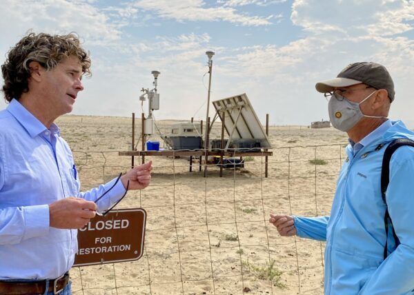
The author explains aspects of the Scripps investigation to DPR Director Armando Quintero.
Oceano Dunes SVRA, Oct. 6, 2020, photo by Sarah Miggins
The SLOAPCD twice revised the Stipulated Order of Abatement (SOA) imposed against DPR and Oceano Dunes. That’s because the SLOAPCD eventually recognized that the SOA’s original goal of eliminating violations of the state’s PM10 standard at a location two miles east of Oceano Dunes was not achievable.
In the latest (third) version of the SOA, it states in Section 3c that the goal now is to “eliminate emissions in excess of naturally occurring emissions from the ODSVRA that contribute to downwind violations” of the PM10 standard. To do this, DPR “shall initially reduce mass-based PM10 emissions within the ODSVRA to a level consistent with the pre-disturbance scenario identified by the SAG in their ‘Scientific Basis for Possible Revision of the Stipulated Order of Abatement,’ dated February 7, 2022.
Emissions shall be calculated using…a representative emissivity grid derived from the PiSWERL measurements as recommended by the SAG and as determined by air quality modeling.”
The Feb. 7, 2022 SAG document referenced in 3c of the revised SOA refers to a target “2013 baseline” PM10 mass emission reduction number of 182.8 metric tons per day. The derivation of that number is not important here. Just know that it comes from computer modeling that uses PiSWERL emissivity data, spring 2013 wind data from the dunes, and that the SLOAPCD and the SAG had for several years considered that particular number as representative of “pre-disturbance” mass emissions.
In their Feb. 7, 2022 document, the SAG notes that refined computer modeling now shows that this “2013 baseline” mass emission reduction target number is too high to be achievable, that even if all of the park was covered with vegetation, the target could not be met. Based on revised analysis and computer modeling as noted in the document, the SAG states that if PM10 mass emissions from Oceano Dunes are reduced to an amount that is 59.3% of the 2013 baseline target reduction number, then modeled PM10 mass emissions from Oceano Dunes will achieve a level consistent with a “pre-disturbance scenario.”
And so with this SOA revision, the “2013 baseline” PM10 mass emission reduction target number was modified to a lower 108.4 metric tons per day value. The SAG then put that new lower number into the computer model along with the 740 plus acres of vegetation plots, and—Shazam!—the model now shows Oceano Dunes to be in compliance with the revised SOA.
Trying to track these numbers, referenced documents, and interations of the SOA seems akin to auditing a complex and questionable tax return. But no matter how convoluted and tortured their accounting practices, the SLOAPCD and SAG cannot conceal that their PM10 mass emission numbers are derived from a PiSWERL device that measures PM10 only as 100% mineral dust.
If PM10 “mass emissions” from Oceano Dunes are to be reduced to whatever baseline target number the SAG chooses, then both the Scripps investigation and the subsequent SLOAPCD/SAG work show that in reality a more than adequate reduction has already occurred. Per Scripps, the mineral dust portion of PM10 downwind from Oceano Dunes is just 14%, and because that is a regional measure, PM10 dust actually originating from Oceano Dunes is surely something less than that 14%. In other words, whatever the amount of PM10 dust that gets lofted by wind blowing over the dunes, nearly all of it falls back to the dune surface. It does not remain indefinitely in the air.
As I stated before, the very low mineral dust content findings invalidate the SLOAPCD/SAG computer modeling which assumes 100% of the PM10 downwind of Oceano Dunes is mineral dust, so I will not delve into that further. What I will say is that the modeling can and should be modified based on the real world data. That is standard operating procedure if one is following the basics of the Scientific Method and computer model development.
In this case, the modification would entail using the PiSWERL 100% mineral dust input from the dunes but also include a regression of mineral dust content in the PM10 as the PM10 is simulated blowing downwind. The end member of that regression would be the 14% mineral dust content, or something similar, as long as it’s far below 100% so that reality is represented. But whether that new model is actually programmed or not, I can tell you what it will show: The 740+ acres of vegetation plots placed within Oceano Dunes were never necessary to lower downwind PM10 levels because Oceano Dunes and OHV recreation are not the cause of the PM10.
As if to underscore this point by demonstrating the futility of the SAG-dictated “mitigations,” in late April/early May, over six consecutive days, there were 14 violations of the state’s PM10 standard in the south-county region that includes Oceano Dunes. Over three consecutive days in mid June there were nine.
That violations here still occur, that PM10 levels continue to consistently rise whenever the northwest prevailing winds blow, show DPR has undertaken the quixotic at the behest of the SLOAPCD. The PM10 issue is far more complex than the SLOAPCD has led the public and DPR to believe. Sorting out that complexity is not the responsibility of DPR. Instead, obviously, that falls to the SLOAPCD. Yet rather than attempt objective investigation, the SLOAPCD has taken DPR for a 25+ million dollar ride that shows no sign of ending.
With the SLOAPCD, DPR executives have hid behind a wall of assumptions, confusing explanations, statistics, faulty computer modeling, and arm waving to justify actions taken and money spent. They want to declare victory at Oceano Dunes while ignoring science and logic that show the financial and recreational acreage sacrifices they made at Oceano Dunes were for nothing. That is not just sad, it is fraud. And it is an all too typical example of politics wagging the good dog of science. It is time to throw that dog a bone and bring him inside. Politics needs to stay outside.
I recognize this information is dense. Regardless, I do not doubt a reader’s ability to follow it, particularly if that person is Wade Crowfoot, who, as lead of the California Natural Resources Agency, oversees DPR. Secretary Crowfoot, with various speeches and particularly with your social media posts, you tout how science provides the light to guide the way. At Oceano Dunes, that light is the actual mineral dust content of the PM10 downwind from the park. If you respect science, and government accountability, shine the light and bring DPR out of the dark. It is well past time to end this charade.
Will Harris is a California-registered Professional Geologist, Certified Engineering Geologist, and Certified Hydrogeologist. From 2005 to 2022, the California Department of Parks and Recreation contracted Mr. Harris to provide geological consulting services and serve as subject matter expert regarding geological processes. Much of Mr. Harris’ work focused on the Oceano Dunes State Vehicular Recreation Area where he investigated the interplay of geology and regional prevailing winds that formed the dunes.


The comments below represent the opinion of the writer and do not represent the views or policies of CalCoastNews.com. Please address the Policies, events and arguments, not the person. Constructive debate is good; mockery, taunting, and name calling is not. Comment Guidelines