Nearly 10,000 gallons of sewage spill into creek in Morro Bay

January 11, 2023
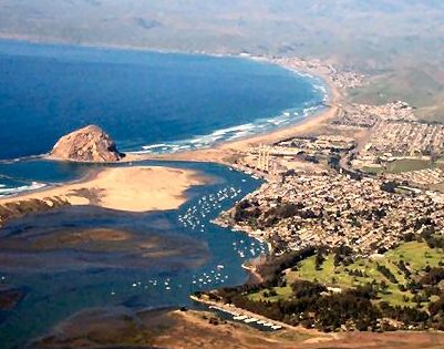
Morro Bay hit with sewage spill

By JOSH FRIEDMAN

Nearly 10,000 gallons of sewage spilled into a creek in Morro Bay amid the storm on Monday, according to San Luis Obispo Public Health Department.

At about 11 a.m., sewage began spilling into Morro Creek at 160 Atascadero Road. Approximately 9,900 gallons of sewage spilled into the creek over 12 hours, health officials said.

Officials are warning residents to avoid contact with ocean water during storms and for at least three days afterwards. Contact with stormwater increases the risk of illnesses such as rashes, fever, chills, ear infections, vomiting and diarrhea.

Rainstorm runoff is known to transport high levels of disease-causing organisms, including bacteria, viruses and protozoa from watershed and urban areas to the ocean. The organisms can cause skin, respiratory and intestinal problems.

Heath officials are advising anyone who inadvertently comes in contact with ocean water following Monday’s sewage spill to monitor for symptoms and contact a doctor if symptoms persist or become moderate to severe.


Loading...
2 Comments
Inline Feedbacks
View all comments

Important story, Josh. This is really alarming.


Part of the City’s response to concerns expressed during the development of the Environmental Impact Report for the WRF project was EIR Master Response 3. Under the heading, “Operational failure at the proposed lift station that may result due to loss of power during earthquakes or flooding”, it states that various lift station components will be “elevated at least two feet above the base flood elevation to reduce the risk of failure due to flooding.”


The base flood elevation is taken from FEMA flood hazard maps. The map in force for the noted Atascadero Road location is dated 2017, and can be seen online. That map focuses on the risks of flooding from Morro Creek, but does NOT adequately address the risks of ocean flooding that have gotten more attention in recent years. As described in NOAA publications, these include king tides and coastal storms. Put those together with sea level rise, and you have a major problem – coastal FEMA maps with base flood levels that may be far too low.


FEMA has begun to address the problem, and is working on revising flood maps for coastal areas. On that agency’s internet site are the following statements:


“To help coastal communities understand and reduce their risks, FEMA has initiated coastal flood hazard studies for 100% of the populated coastline.”

AND,

“Through Risk Mapping, Assessment and Planning (Risk MAP) , FEMA is updating the nation’s coastal Flood Insurance Studies (FIS) and Flood Insurance Rate Maps (FIRMs, or flood maps), where appropriate, and publishing new flood maps of densely populated areas that were not previously mapped. With these new and updated maps, communities can make floodplain management decisions based on the best available scientific information.”


That’s great, but it does not appear that FEMA has gotten to Morro Bay yet, so the elevation of the critical components of the lift station was based on the old 2017 FEMA map done before the current FEMA coastal flood hazard mapping project began.


Did that huge sewage spill occur because critical components of the lift station were impacted by flood waters – because the WRF project people didn’t do their homework? Sewage spills don’t just happen for no reason.


nearly 10,000 gallons? whoa, well wait a minute. A typical water truck that we see on the highway is designed to carry 5,000 gallons. So if almost two truckloads of raw sewage were lost from the existing (soon to be decommissioned) waste water treatment plant while it was inundated with floodwaters that closed highway 1, is this really news worthy? The new wastewater treatment plant is still functioning perfectly (miles away) and the pump station that moves waste from the Atascadero lane site is also still functioning perfectly and is elevated way above the flood level. C’mon Josh, fill us in on the context not the big numbers that actually mean so little. No one was going in the water during these storms.