Aerial footage shows extent of Highway 1 landslide

May 26, 2017

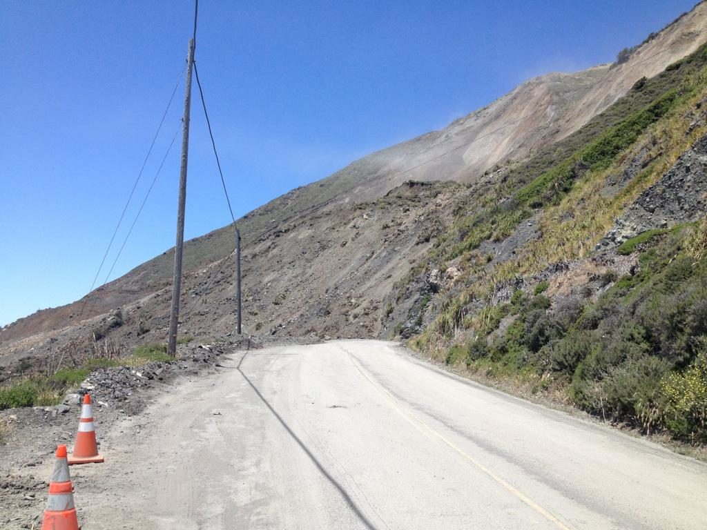
A massive landslide that occurred Saturday at Mud Creek in Big Sur has shut down an approximately one third-mile stretch of Highway 1 on the Central Coast for the foreseeable future.

The closed stretch of Highway 1 is located eight miles north of the Monterey-San Luis Obispo County line and about 10 miles north of Ragged Point. The landslide is about 1,500 feet wide and about 40 feet deep with debris extending 250 feet beyond the shoreline.

Earlier this week, the Monterey County Sheriff’s Office flew an Idaho 90 plane over the landslide. The video gives a glimpse of what is needed to repair and reopen the road, a sheriff’s office Facebook post states.

Caltrans, which is also grappling with other issues on Highway 1, has not given a timeframe for repairing the stretch of roadway at Mud Creek.

“No words needed but here’s a few: millions of tons of rock/dirt, about 1/3 mile of roadway covered 35-40 feet deep. Mother nature hard at work,” Caltrans stated in a tweet.

The Highway 1 closure is expected to have a big impact on businesses in the area, including the Ragged Point Inn. The inn is now only accessible to northbound traffic on Highway 1.


Loading...
9 Comments
Inline Feedbacks
View all comments

Every since the slides Cal Trans has been trying to get exemption from the Coastal Commission and others to push the dirt into the ocean where nature would of put it anyway ,so that seems a little mute now. I wonder if the Coastal Commission will require Cal Trans to truck away the dirt that nature put in the ocean when Cal Trans couldn’t. I’m sure they will try.


When you think about it; God or Nature did us a favor that is a LOT of fill.


Think of the cost of building a bridge or an anything else there.


Now, we have enough earth to create a nice sable road bed.


The slide area is gone and created a 16 acres of new beach, that is self packing.


That part of HWY 1 always creep me out, I guess that feel slide to the ocean.


Build a dock on each side and start ferry service around the slide.


So the thumbnail photo on the CCN homepage is it? That’s the sum of aerial photos, the large photo here is a roadside pic.


Is there a question or comment (or anything of value) in this statement? Yeah, the thumbnail is for the video, the article also has a roadside picture… is this a problem, or a congratulations? Or are you just happy you can identify two different media stills?


I liked both the aerial video (including the thumbnail on the home page) and the ground-level photo – it gives perspective on the scope and scale, which is precisely what the article is about. Go figure.


I didn’t see or have a link for an aerial video; just thumbnail (no link) and ground pic. Foolish me, the article was titled aerial views and I assumed there would be some. My deepest apologies for offending you


After doing some work on one of the slides a few years ago, I realized that Hwy one will be normally closed rather than normally open:(

I guess my prediction has come true:(

Not long ago, when a slide occurred, they would get some D-8’s and start at the top of the slide and slope it back to a safe grade and push the over burden out into the ocean, being that slides were a natural occurring event. Now they helicopter in tonka toys to the top of the slope, only removing the loose material, and truck off the over burden, taking much longer, phenomenally more expensive, as well as taking a very long time to accomplish. The finished product not being nearly as good, as well.


D-8’s!? Pshah! Get a RH400 hydraulic shovel in there, and move that little hill in a couple days!


I believe D-8s are as heavy of a piece of equipment that the road and bridges going up there can handle:)

Little birdie at Cal Trans told me that they are filing for a exemption to actually do what I was suggesting:) Cal Trans Engineers are pretty smart cookies, problem is they tend to succumb to the rules, instead of pushing through them, like a private entity would do, it’s not their money:(